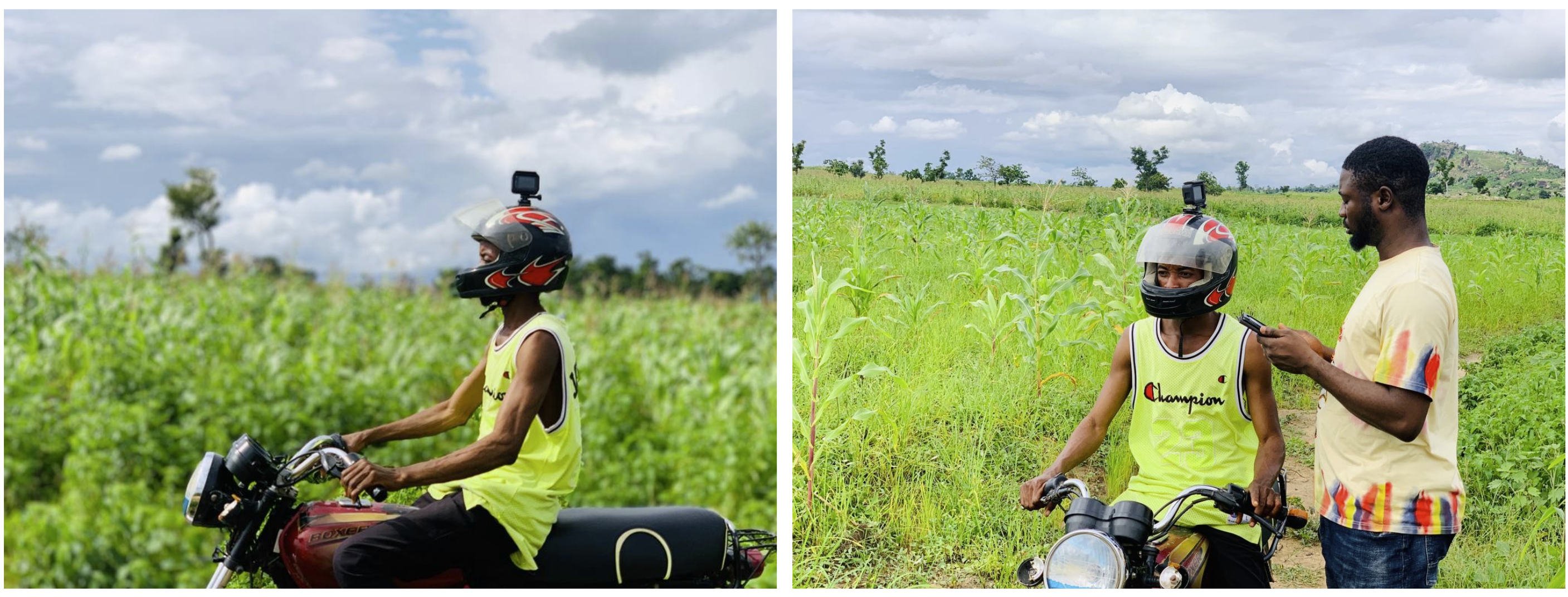
The Helmets Labeling Crops Project (“Helmets” for short) is developing and applying innovative, scalable data collection approaches that can inform machine learning (ML) tools to support higher-frequency crop-type mapping. Our data processing platform, called Street2Sat, transforms geo-tagged street-level images collected by Helmets GoPro cameras into a set of labeled geo-referenced points on crop fields that can be paired with satellite images for downstream tasks such as crop type mapping. Checkout our Street2Sat Github repository. cnakalem@umd.edu to Request a Helmets Kit Application form.
To learn more about the data collection process check out the
Car and Motorbike Toolkit below:
(use full screen for best view)
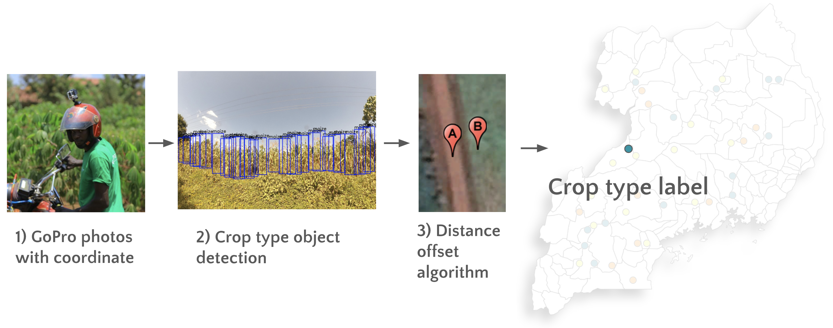
The goal of Street2Sat is to turn geo-referenced images acquired from roads into geo-referenced labeled point samples with locations corresponding to objects of interest in the images. The pipeline consists of data collection, preprocessing, object detection, depth estimation, relocation, and quality assessment/control (QA/QC).
Paliyam, M., Nakalembe, C., Kerner, H. (2021). Street2Sat: A Machine Learning Pipeline for Generating Ground-truth Geo-referenced Labeled Datasets from Street-Level Images. Proceedings of the International Conference on Machine Learning (ICML) Workshops, Tackling Climate Change with AI, link
Manimurugan, S., Singaram, R., Nakalembe, C., and Kerner, H. (2022). Geo-referencing crop labels from street-level images using Structure from Motion. Proceedings of the 73rd International Astronautical Congress (IAC), link.
Helmets Labeling Crops Project is funded by Lacuna Fund. The Lacuna Fund is an initiative co-founded by The Rockefeller Foundation, Google, and Canada’s International Development Research Centre which aims to mobilize funding to support the development of high-quality labeled datasets in low- and middle-income contexts. The first round of funding in the agricultural AI for social good domain has now been awarded to several projects aimed at solving urgent regional problems in African countries, working hand-in-hand with organizations across Africa. This effort is supported through partnership with affiliate organizations across the NASA Harvest consortium: